End of Flood Warning - Lake Nipissing shoreline, La Vase River downstream of Lakeshore Dr. and Parks Creek
Message Number: 2026-19
Issued: May 26, 2026 at 3:30 PM EDT
From: NBMCA Duty Officer, Githan Kattera
This message is to advise that the Flood Warning for the Lake Nipissing Shoreline, La Vase River downstream of Lakeshore Drive, and Parks Creek has ended.
This is an update to the previous Message Number 2026-18 dated May 26, 2026.
Current Conditions:
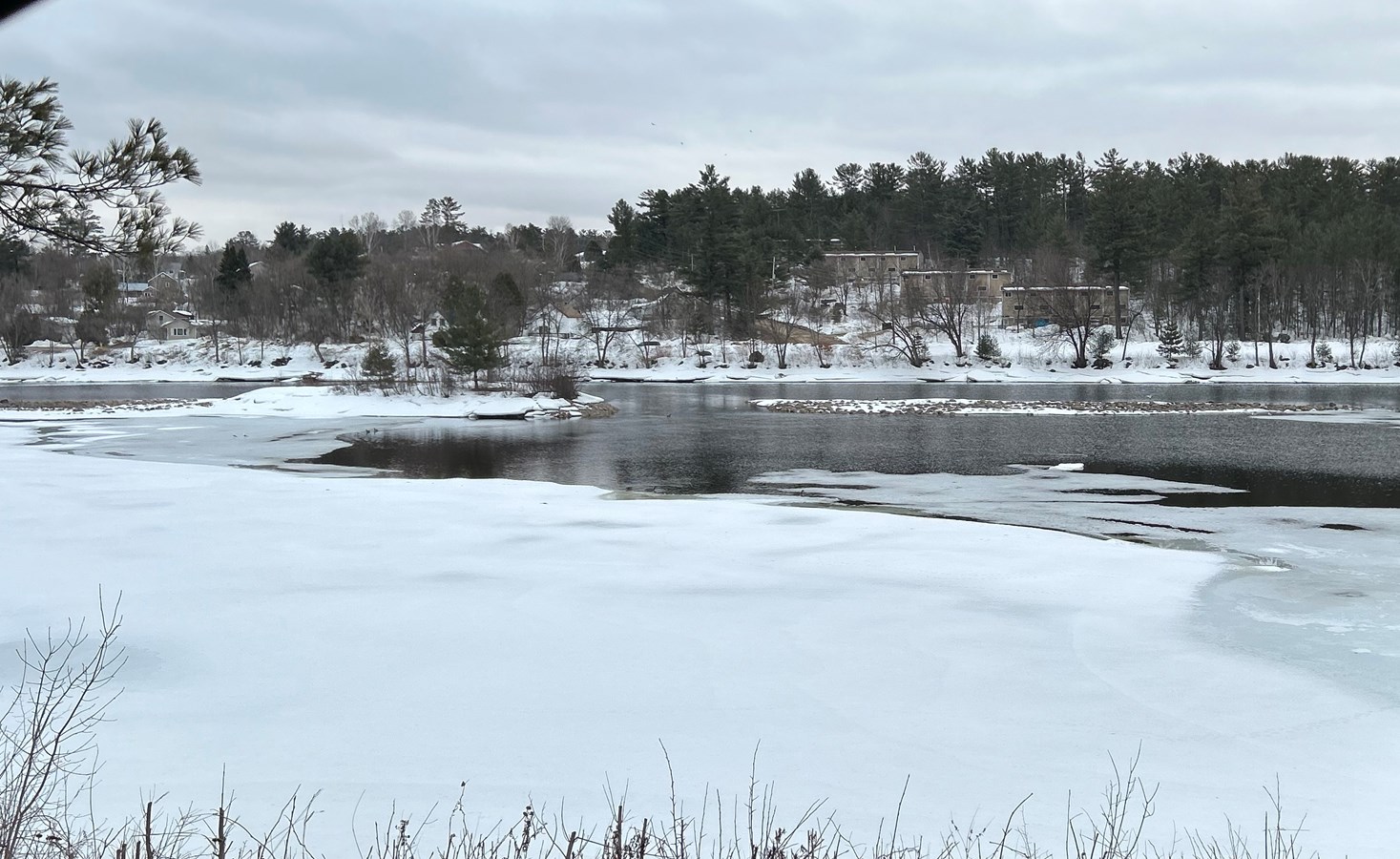
Water levels and flows across the watershed have continued to recede following the spring freshet. Lake Nipissing is now below the non-damage level and continues its seasonal decline. Tributaries, including the La Vase River and Parks Creek, have returned to typical seasonal conditions, and no flood concerns are currently present across the watershed.
Current water levels can be viewed by searching Station Names “Ottawa River”, “Mattawa River”, “Chippewa Creek”, “La Vase River”, “Wasi River”, and “Lake Nipissing” at https://wateroffice.ec.gc.ca/search/real_time_e.html
Forecasted Conditions:
Approximately 10 to 15 mm of rainfall is forecast for Friday, June 5. This precipitation may result in minor increases in water levels and streamflows; however, significant rises are not expected, and flooding is not anticipated under current forecast conditions.
Water levels on Lake Nipissing are influenced by inflows from tributaries, precipitation, and outflows through the control dams to the downstream French River.https://www.canada.ca/en/public-services-procurement/services/infrastructure-buildings/bridges-docks-dams/frenchriver-dam.html
The Ottawa River water levels at Mattawa have returned to seasonally normal conditions. The Ottawa River water levels are managed by dams and reservoirs operated by provincial and federal governments. The Ottawa River Regulation Planning Board posts current data and forecasts on their website https://ottawariver.ca/
North Bay-Mattawa Conservation Authority staff will continue to monitor weather and watershed conditions as part of the Authority's Flood Forecasting and Warning Program.
Community Engagement
The general public is advised of these messages through the www.nbmca.ca website with the flood status icon and a link to information about current conditions. NBMCA also circulates these messages to local media and social media, posting on Twitter (@theNBMCA), Instagram (nbmcainfo), and Facebook (NBMCA).
The public is invited to share photos of watershed conditions on social media using #NBMCAFlood.
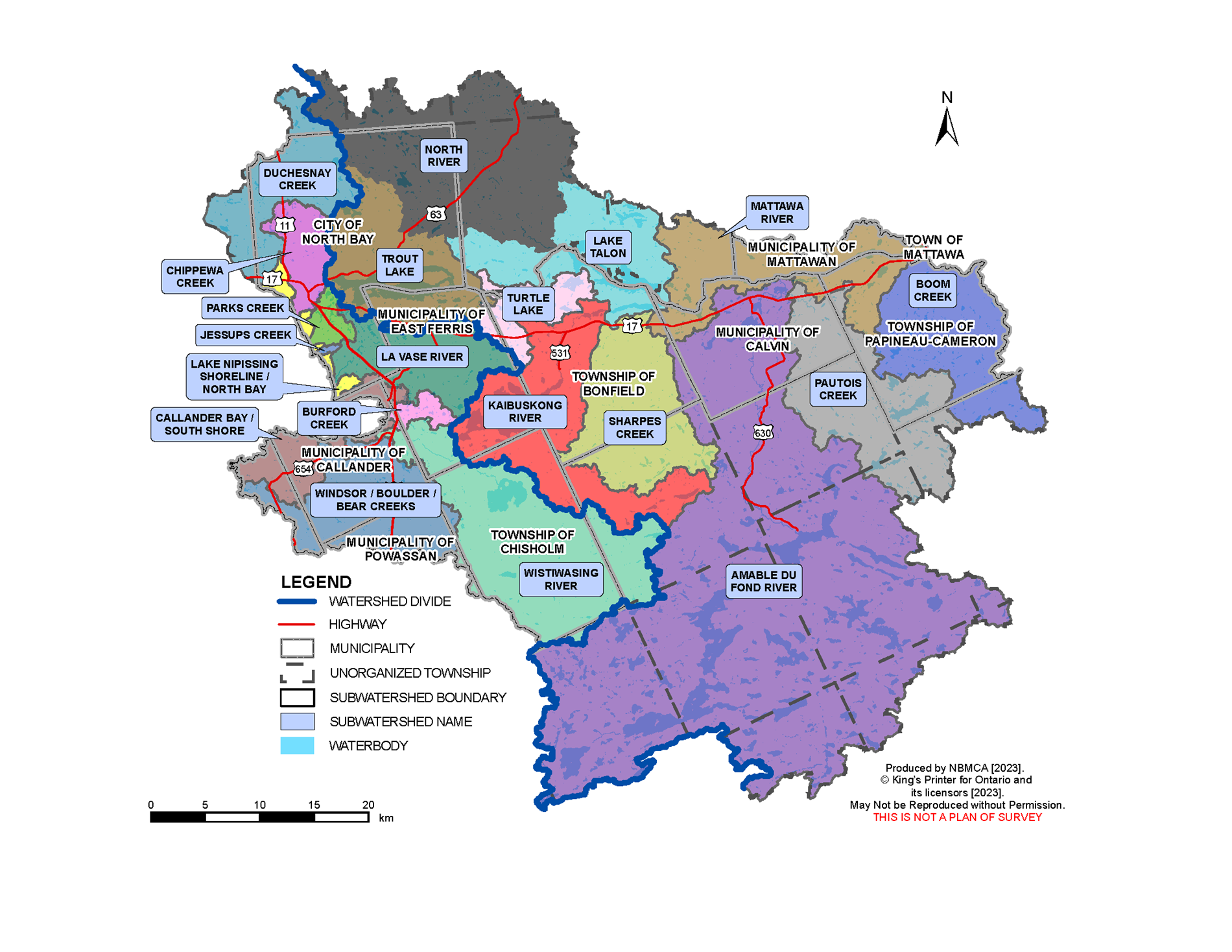
Lake Nipissing
Flows through the dams are based on daily analysis of the current status of the lake and river and as agreed to by the Sturgeon-Nipissing-French-Wanapitei Water Management Group. Weather forecast is considered, along with the inflows from the upper watersheds and outflows through the dam to the French River.
You can view the current level on Lake Nipissing at North Bay on the graph below and the French River at the Water Survey of Canada (WSC) website. Fluctuations in the levels are a result of the strong winds affecting the movement of surface water. Water level and flow information for the South River and Sturgeon River systems is available from Ontario Power Generation (OPG).
Flood warnings for Ontario can be found on the Ontario Flood Forecasting and Warning website.
Why the fluctuation in water level readings on Lake Nipissing? Lake Nipissing can sometimes act like a bathtub, with water shifting in the lake, depending upon wind direction, speed and atmospheric pressure - known as a wind surge or seiche. At times the wind can have such an impact that it may result in the level being higher or lower at the French River gauge compared to the gauge located on the North Bay shoreline.
Mattawa River
The current Ottawa River water level may be viewed at the Water Survey of Canada (WSC) website (note that there is a delay of several hours, and 100m should be added to the gauge reading for metres above sea level).
The Ottawa River Regulation Committee and Ontario Power Generation which operates the Otto Holden Dam provide information online regarding the management of water levels on the Ottawa River. To view water levels and current conditions on the Ottawa River visit the Ottawa River Regulation Planning Board and Ontario Power Generation.
Watercourses and Monitoring throughout the Watershed
There are other watercourses within the NBMCA jurisdiction which are monitored by NBMCA and other agencies. These gauges are maintained by Water Survey Canada - Environment Canada and can be viewed in real-time online.
- Chippewa Creek at North Bay
- Lake Nipissing at French River
- Lake Nipissing at North Bay
- La Vase River at North Bay
- Ottawa River at Mattawa
- Wasi River near Astorville
In addition to the Water Survey of Canada gauges, there are other staff gauges which are monitored by NBMCA or the Ministry of Natural Resources and Forestry:
- Chippewa Creek
- Lake Nosbonsing Dam
- Mattawa River at Hurdman Dam
- Parks Creek
- Trout Lake
- Turtle Lake
- Talon Lake
Is your property at risk of flooding?
If you think that your property may be at risk of flooding, please contact your municipality.
If you live in an unorganized township, contact Ministry of Natural Resources and Forestry District office at 705-475-5501.
More Information
- The North Bay-Mattawa Conservation Authority delivers its flood forecasting program and updates for municipalities, agencies, our partners, and the public as part of our natural hazard management initiatives. These updates are based on the analysis of data and information collected in concert with the following:
- Environment Canada (Weather)
- Mattawa River below Bouillon Lake
- Ministry of Natural Resources and Forestry
- North Bay-Mattawa Conservation Authority
- Ottawa River Regulating Committee
- Ottawa River Regulation Planning Board
- Public Services and Procurement Canada
- Sturgeon-Nipissing-French-Wanapitei Water Management Group
- Surface Water Monitoring Centre
- Water Survey of Canada
- Weather Network